Examples
Nine routes worth looking at, each one a live map rather than a screenshot, and a sample flown track raced against its great circle. Spin a map, replay the show, then copy the route text into Voyarc and make it yours. Every distance, heading and duration below comes from the same geodesy the app prints: the arcs are great circles, and the distances are measured on the WGS84 ellipsoid.
Sydney to London flight distance
2 routes · SYD-LHR 17,016 km · SYD-JFK 16,013 km · longest about 20.5 h at 830 km/h
SYD-LHR, SYD-JFK
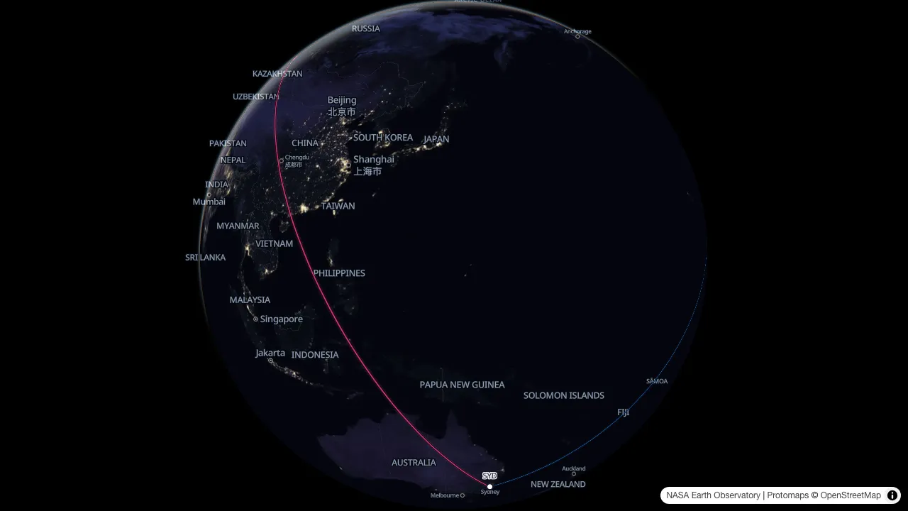
Two ultra-long-haul nonstops are planned out of Sydney, one to London and one to New York. Either would be the longest scheduled passenger flight ever flown; a lightly loaded research flight covered the New York pairing in just over nineteen hours in October 2019. On the globe the London arc explains itself: out to the north-west, over Southeast and Central Asia, down on Europe from the east.
Longest flight in the world
15,349 km · initial heading 357° · about 18.5 h at 830 km/h
SIN-JFK
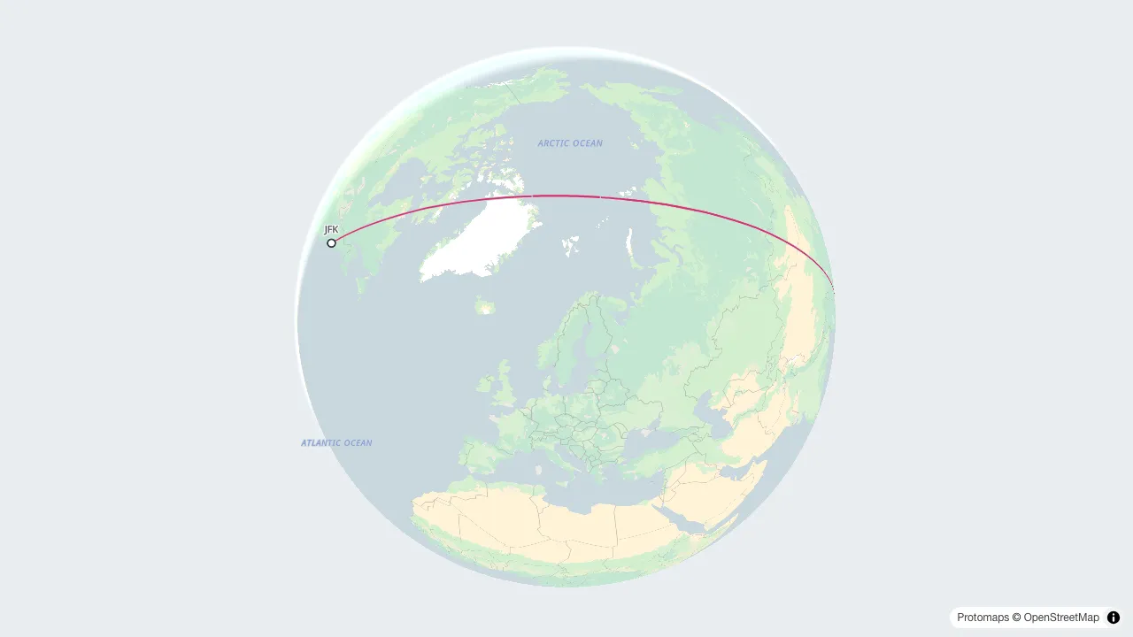
The longest scheduled nonstop flying today runs Singapore to New York. The great circle leaves Singapore close to due north, crosses China and eastern Russia, passes near the pole and comes down over Canada. These are two cities either side of the Pacific, and the flight spends most of its time in the Arctic. On a flat map that track reads as a detour. On the globe it is the straight line.
Melbourne to Sydney distance
706 km · initial heading 056° · about 1 h at 830 km/h
MEL-SYD
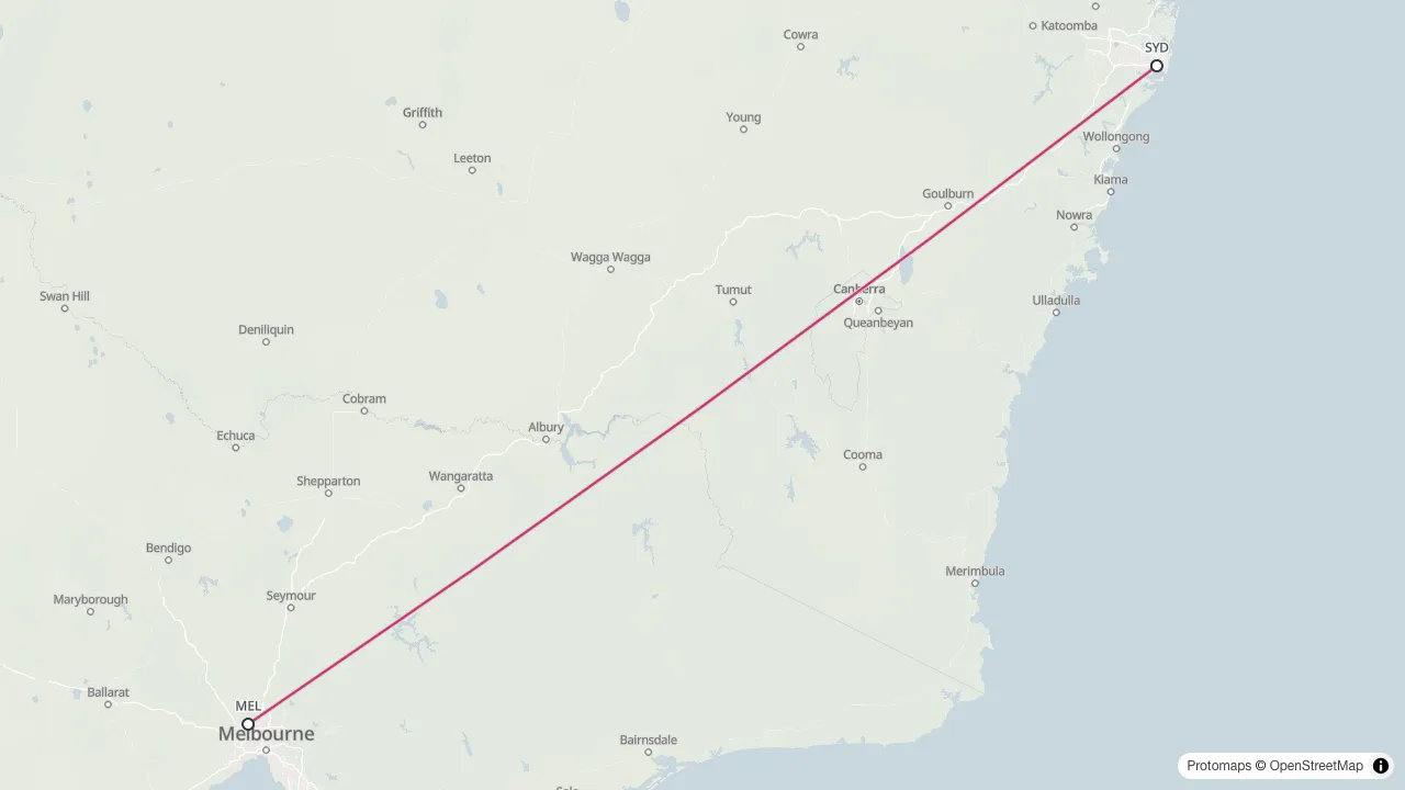
Melbourne to Sydney is one of the busiest air corridors on earth, with departures every few minutes through the working day. It is also short enough that the curvature barely shows: over this distance the great circle and the flat map's straight line sit almost on top of each other, and the gap between them is thinner than the line drawn. Curvature is a long-haul effect; this is the control case.
Dubai flight routes map
24 routes · 189,007 km of arcs · longest DXB-AKL 14,199 km
DXB-LHR, DXB-CDG, DXB-FRA, DXB-JFK, DXB-LAX, DXB-SYD, DXB-MEL, DXB-SIN, DXB-HKG, DXB-NRT, DXB-JNB, DXB-CPT, DXB-GRU, DXB-EZE, DXB-BOM, DXB-DEL, DXB-BKK, DXB-MNL, DXB-AKL, DXB-YYZ, DXB-MAD, DXB-FCO, DXB-SEA, DXB-CAI
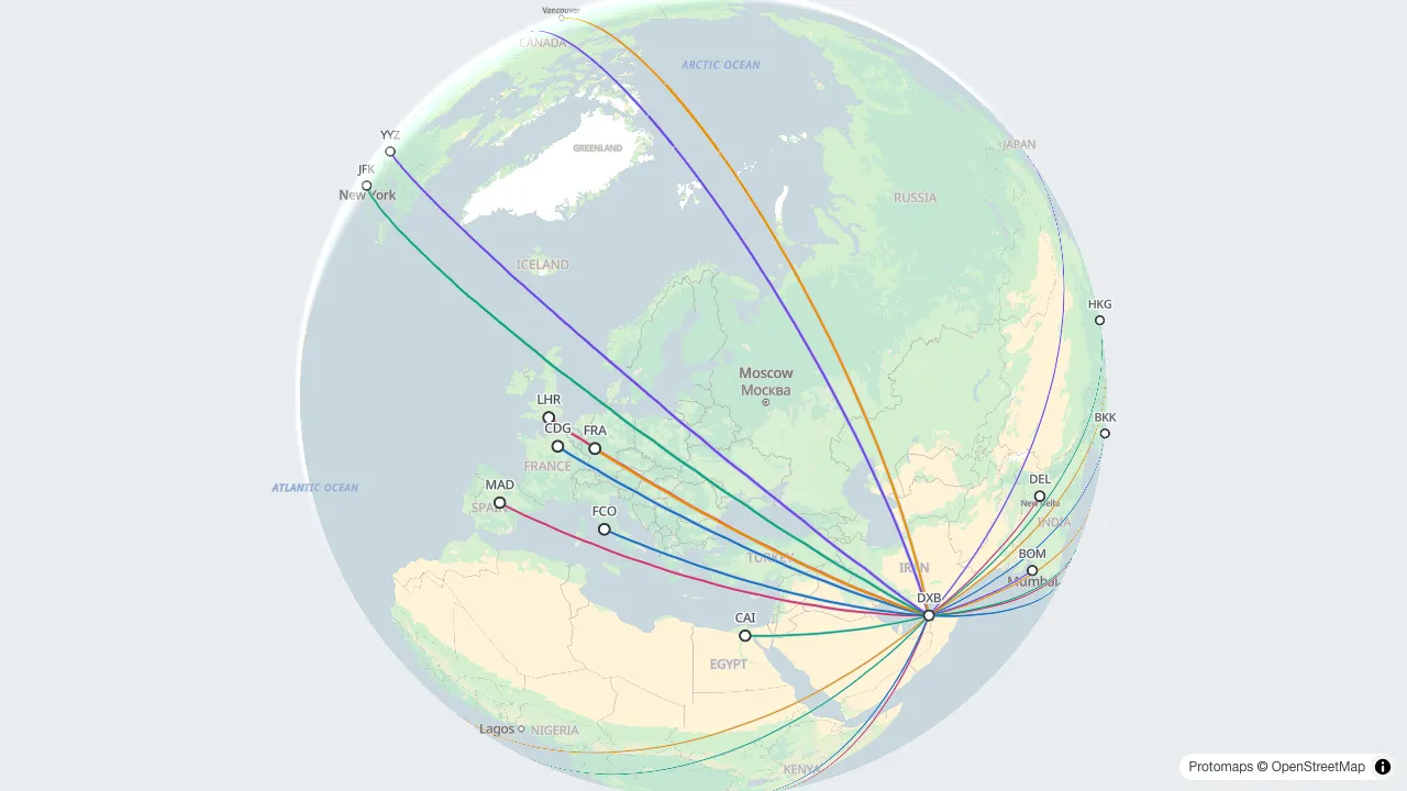
A hub near the middle of the old world reaches six continents inside one aircraft's range, and the whole fan drawn at once shows why that geography was worth building on. Every arc starts in the same place, so it reads as a hemisphere of destinations rather than a list of city pairs. Spin the globe and routes that look wildly divergent on a flat map turn out to be neighbours.
Round the world flight itinerary
38,764 km · 5 legs · first leg heading 298° · about 46.5 h at 830 km/h
SYD-SIN-LHR-JFK-LAX-SYD
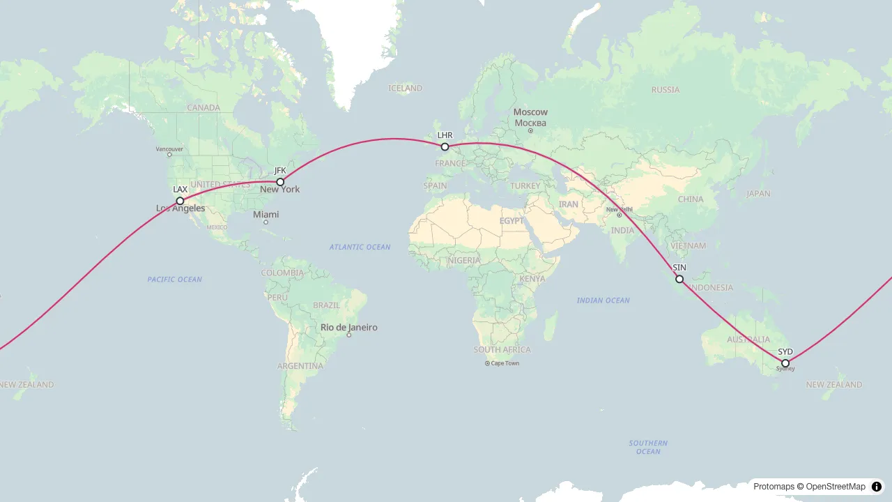
A circumnavigation entered as one journey rather than five bookings: west out of Sydney, around, and back to it. Voyarc flies the legs in order and totals them, so the whole trip comes down to one figure. A loop like this one comes in under a lap of the equator (40,075 km) because most of it is flown well north of it, where the parallels are shorter.
Auckland to Santiago flight route
3 routes · AKL-SCL 9,674 km · NRT-LAX 8,772 km · SYD-SCL 11,363 km · longest about 13.5 h at 830 km/h
AKL-SCL, NRT-LAX, SYD-SCL
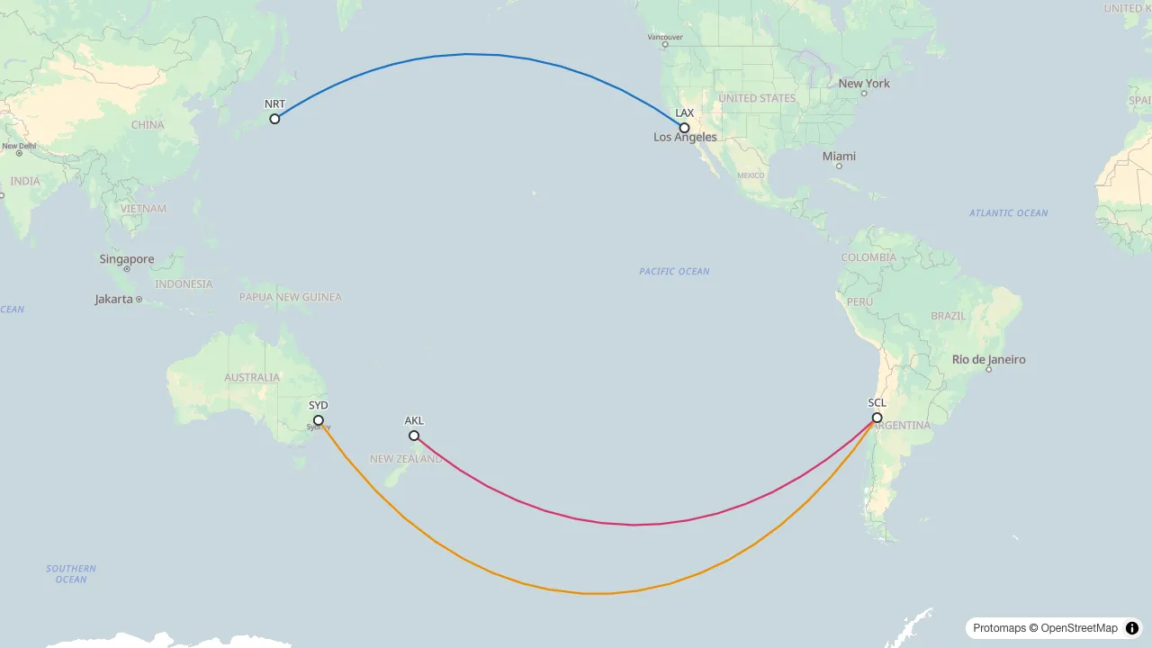
Three Pacific crossings, every one over the antimeridian. A flat map has to cut the world open somewhere, and the cut runs down this ocean: an arc leaves one edge and returns on the other. Voyarc splits the arc at the seam instead of dragging a false line back across it. On the globe there is nothing to split: the edge is a property of the paper, not the planet.
New York to Hong Kong flight path
12,990 km · initial heading 352° · about 15.5 h at 830 km/h
JFK-HKG
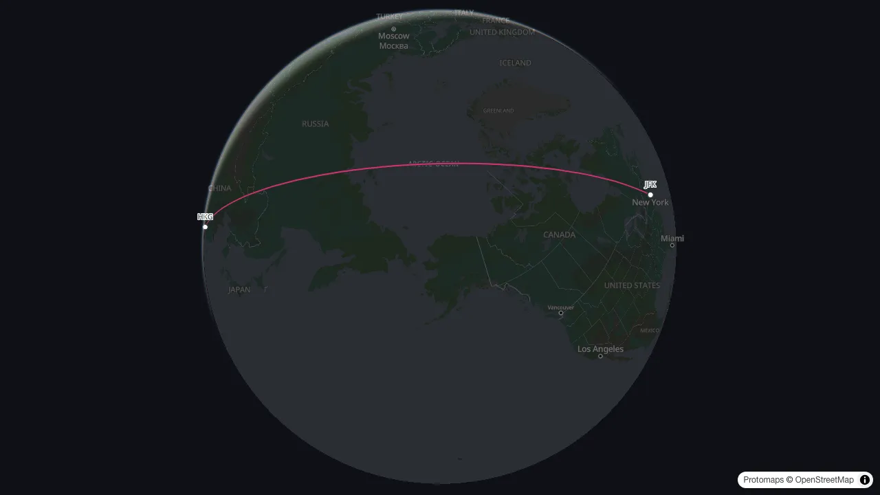
New York to Hong Kong is the textbook polar case. The shortest path leaves New York heading nearly due north, crosses the Arctic Ocean close to the pole, and comes down through Siberia and eastern China. A flat map invites two other answers (east across the Atlantic and Asia, or west across North America and the Pacific), and both are thousands of kilometres longer than the route an aircraft actually flies.
Flight log map with repeat routes
6 routes · 71 flights · 24,204 km drawn · 109,730 km flown
MEL-SYD x40, MEL-BNE x12, MEL-PER x6, MEL-ADL x8, MEL-SIN x3, MEL-LAX x2
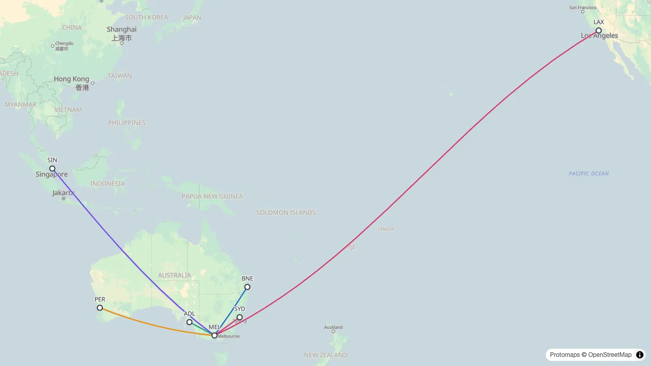
A year of flying written as counts: each city pair once, with the number of times it was flown after an x. The map draws one arc per pair (forty overlapping Melbourne to Sydney lines would only ever look like one), while the totals count every flight, so a logbook that is mostly the same short hop still adds up honestly. It is the shape Import CSV writes into the route box.
How far is 3,000 nautical miles from Perth
3 routes · PER-SIN 2,103 nm · PER-JNB 4,495 nm · PER-LHR 7,829 nm
PER-SIN, PER-JNB, PER-LHR
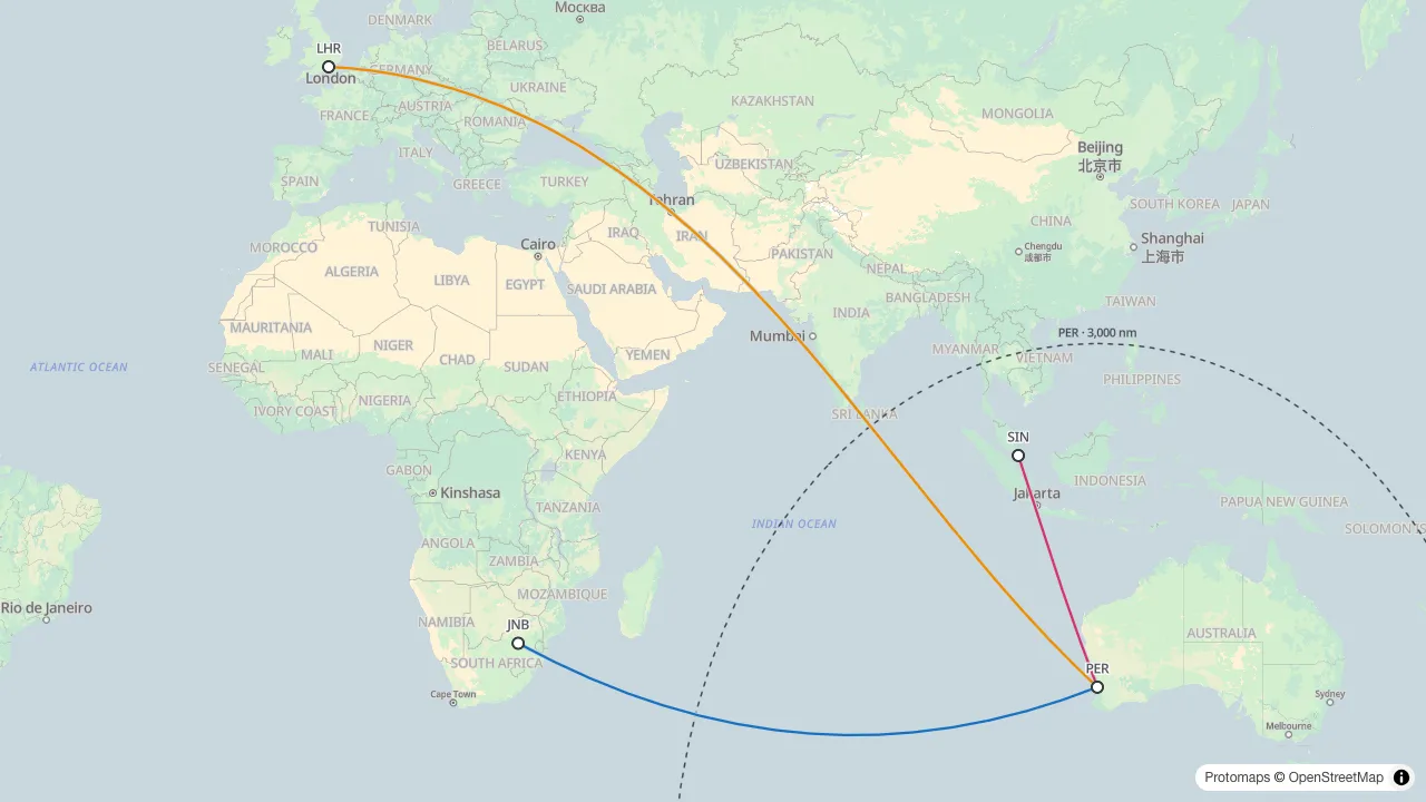
A range ring makes a planning question into a picture: a 3,000 nautical mile circle on Perth, and you can see which of these city pairs sit inside one hop and which are a different kind of flight. The ring is a geodesic circle, so it bends on a flat map for the same reason the routes do. Rings can be drawn as diversion times as well, the form flight planners use.
Flown track against the great circle: Perth to Rome
Perth to Rome flight path · 13,354 km great circle · 13,651 km flown
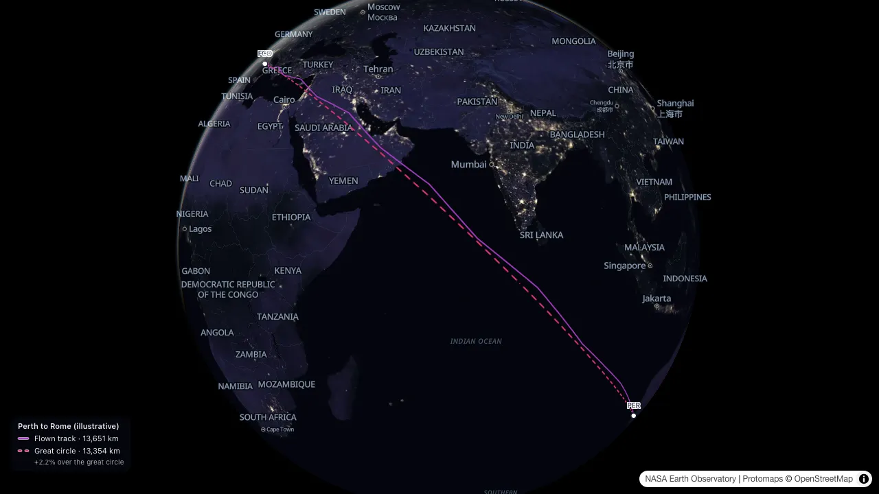
Two planes off the blocks at the same airspeed: the great circle, and the path the aircraft actually took. The one that went out of its way lands late, and how late is the whole story.
To try it: open Track in the panel's Map row and import
the sample track. Voyarc
writes PER-FCO into the route box, lands the map on the
track, and pulses Fly.
How to do it with your own flight → Guide.
This track is illustrative: generated by Voyarc to show the comparison, not a recording of any flight. Voyarc is not affiliated with or endorsed by any airline or flight-tracking service.